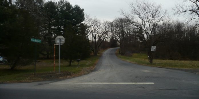
After a three-month hiatus, the 11-unit proposed subdivision on Feller-Newmark Road was back in front of the Red Hook Planning Board April 7.
After a contentious public hearing Jan. 6, board chair Christine Kane told the applicant to submit written responses to many of the questions residents and board members had asked about the Preserves at Lakes Kill subdivision.
At the April meeting, Kane said that the board has received a 41-page technical document from the applicant, Landmark Properties, in response to questions about zoning irregularities, wastewater, sight distance, road width and density manipulation.
Engineer for the project Mike Bodendorf and attorney John Wagner were at the meeting. Bodendorf explained they had received consulting traffic engineer Bill Fitzpatrick’s letter asking for sight distance profiles for all the driveways and elevation tables along the road. He said these are almost done but are not ready for submission yet.
Kane then opened the hearing to public comments. The room was only half full and, unlike the December and January meetings, there were only a handful of comments.
Two of the speakers were fairly blunt.
Douglas Lee is the new owner at 20 Kristen Lane, directly across from the proposed entrance to the subdivision. He said he and his wife purchased the house in January knowing nothing about this development.
“We moved from the city to provide a safe and quiet upbringing for our toddler and having his school bus stop right across from a large intersection is what we came up here to avoid,” he said. “It’s my understanding the developers might need to somehow acquire some of our land … If someone comes to take our land and if there’s any hint of approval from this board that that’s going to happen, we’re not going to wait for shovels to hit the ground, we’re going to hire separate attorneys and we will sue the town.”
Dan Danzig of 34 Kristen Lane wanted to know if the town was going to raise the service levels for the road to include more sanding, salting and plowing, to make it safer if this development comes in. He told a harrowing story about the aftermath of the January snowfall when the weather warmed up causing ice melt, only to re-freeze at night.
“The entire road became a sheet of black ice,” he said. “I didn’t notice it and when I drove out on the road, the car wouldn’t stop and I hit a rock, causing $4,000 worth of damage.”
After the public comments, Kane said, “All these topics have been brought up before: the questions involving water, road layout, lot layout, sight distance, and turning requirements.” She also said that Fitzpatrick has more questions on the road design, and that a memo from the town planner also questioned the road width.
Board member Sam Phelan asked if the legal status of the road had been resolved and what is the applicant’s legal authority to make changes to it.
Kane said that legally it’s a “user road,” which means the public can use it and the property owners own the land to the center line of the road.
“But it’s not that simple,” she added. “…I think everybody agrees it’s a user road in terms of labeling it, but there are a lot of conflicting court decisions and that is where we are now.”
She suggested more research was needed on who can build what where.
Kane then discussed closing the public hearing with the board, noting that they have held more hearings than required.
The board voted unanimously to close the public hearing but allowed an extra two weeks, until April 21, for additional written comments. The applicants’ written comments are available at Town Hall.


Facebook Comments